Monday, June 29, 2015

Two Weeks in Alaska

It's been a busy and exciting two weeks in Alaska, lots of adventures and hundreds of great photos and stories to share!


We decided to take the Alaskan Highway from Whitehorse, Yukon to the Alaskan border. The road was a mess with over 100 miles of gravel and dirt due to construction but we made it to Tok, Alaska with no trouble. The most obvious evidence of our trip on the Alcan highway was an amazingly thick layer of dirt. Our first job in Tok was to wash everything!

We had replaced some tires in Whitehorse right before we left and shortly after arriving in Tok, Charles realized he had left his computer at the tire shop in Whitehorse. He  made the messy 800 mile round trip in one day (cartoon here)!

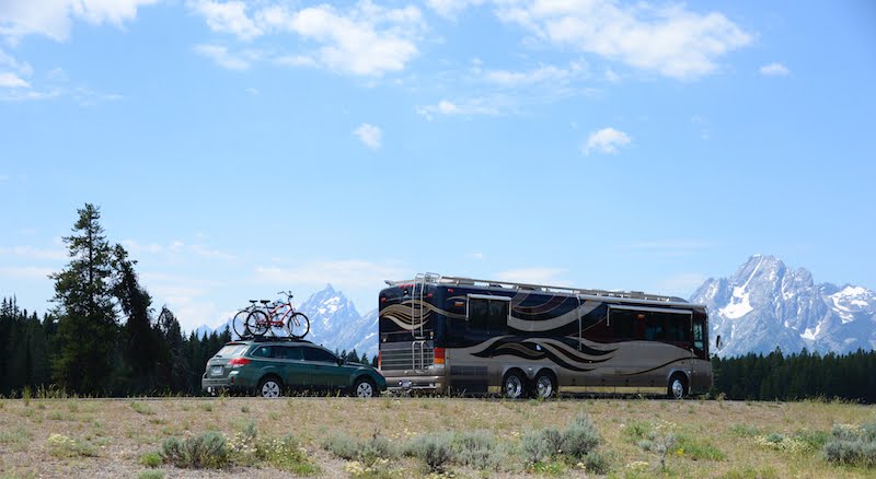
Tok is the hub of most routes from Canada to Alaska; a place to decide where you'll go next. We chose Fairbanks, 200 miles northwest.  Fairbanks is a lovely small town (45,000 people) and a great place to celebrate the Summer Solstice. in late June they get around 22 hours of sunlight a day and the other 2 hours feel like dawn or twilight. It's also a great place to relax, make new friends, stock up on groceries, and drive the car to other great spots not so accessible by coach.

Fairbanks and nearby adventures

While in Fairbanks we took the 200 mile gravel drive to the Arctic Circle and back. It was a great chance to see some of the Alaskan tundra, the pipeline, and of course the Arctic Circle. We also took a side trip down Elliot Highway to The Manley House, a roadhouse established in the early 1900s to support gold mining in towns nearby. 

We spent a day in Fairbanks exploring the town and really enjoyed the Museum of the North at the University of Alaska.


We had been warned that wildfires might make some parts of Alaska less pleasant during the Spring and Summer and a rash of storms and lightening strikes soon had Fairbanks and areas northwest covered in a dense smoke. We found there were fewer reported fires in the south (300 in the entire state) so we escaped to the south. In Fairbanks we met Chris and Mac, on another Bluebird Wanderlodge, and they decided to travel with us. We are now a Tribe!


We set our sights for Valdez and made a number of short jumps to get there. We took a short side trip on the unimproved but scenic Denali highway and stopped at a lovely wooded campground midway on the Richardson highway. 

Denali highway and fish ladder at Chitina

Further south on the Richardson highway we went East on the Edgerton highway to Chitina then McCarthy/Kennecott to visit the Wrangell-St Elias National Park and take a flight over the glaciers.

Kennecott glacier and mine from the air plus restored mining town

Our last leg of the trip to Valdez was over the Thompson Pass with beautiful views of the Worthington glacier and the Chugach mountain range.

Worthington Glacier - 30 miles north of Valdez

More adventures coming up in Valdez so stay tuned. Here's a map of the Alaskan roads we've traveled so far. There aren't that many in Alaska and you can see we've done quite a few already!

Our Travels in Alaska so far

Here's the link to our travel photo collection on Flickr, newest photos first: Flickr photos


Monday, June 15, 2015

The Big Bang Theory

On Thursday, June 4th we arrived at Dawson Creek, the official start of the Alcan highway.

Aside from the mile zero marker, there's not much to see in Dawson Creek so we left the next morning. Our next stop was Fort Nelson and after we got settled we went for a walk. We're now in a part of Canada where towns are the size of a few football fields so walking to local attractions is always the best choice. The highlight of Fort Nelson was their Museum.

Part museum, part junkyard, it was poorly lit and missing labels and a narrative, and absolutely wonderful. We wandered slowly through the rooms squinting and remarking when we discovered treasures hiding in the dusty shadows. Lot's of gold rush and Alcan highway related artifacts. In a tiny room with four theater seats we watched a 1950s documentary about the building of the Alcan Highway.


Saturday, June 6th, we headed for Liard River Hot Springs. It must have been National 'Wildlife by the Road Day' because we saw a lot of critters: a baby black bear, a goat family, two moose, and a herd of bison. We arrived in the provincial park and found a great wooded spot with easy access to the hot springs. This is the only hot spring we have seen that has been left in its natural state and not converted to swimming pool. The decking and steps blend in well with the natural environment making it a peaceful retreat (until the kids show up with swim noodles and inner tubes).

We left Laird Hot Springs after 2 nights and headed for Watson Lake in the Yukon Territory. This is a 'must stop' on the trip north because they have a sign forest where you can post your own sign that you were there. The sign forest has been around since the 1950s and currently has over 80,000 signs posted by travelers. It was a challenge to find free space on the posts for our signs (Tucker the cat had a sign as well). We wandered around the forest for a long time reading the signs and wondering about all the travelers who had come before us.


Our next stop was Whitehorse, the capital of the Yukon Territory. A large town by Yukon standards, we found a Walmart and decided to park there for the night. While parked we took a drive over to the MacBride Museum of Yukon history and learned about the town history, the gold rush, and Yukon's famous poem "The cremation of Sam McGee". While Sam McGee was a real person and resident of Whitehorse, he was NOT actually cremated as the poem suggests. Poet Robert Service just liked the sound of his name so asked if he could use it in the poem. Little did Sam McGee know the poem would become famous in his lifetime. While traveling north in The Yukon, Sam once met a man claiming to have the ashes of Sam McGee. He was so amused, he kept his identify to himself and bought the ashes from the man.


At Whitehorse we had a choice, keep going on the main highway or take a detour north on the Klondike Highway to Dawson City, the famous gold rush town. We chose the Klondike highway.


Our first stop was just 30 miles north of WhiteHorse at Lake Laberge campground. The lake was made famous by the poem mentioned above. If you've not read the poem go read it now, you'll love it. Be sure to come back here though, our story gets exciting...

Follow this link to read the poem

The next day we drove North, stopping at Braeburn Lodge for the world's largest Cinnamon Bun. Freshly baked cinnamon buns have been a common ploy to attract visitors along the highway and this one we could not pass. Rumor has it that one bun feeds four people - we had to see for ourselves. The lodge is also an official stop for the 1000 mile "Yukon Quest" sled dog race from Whitehorse to Fairbanks that's held each February.


Full of coffee and cinnamon buns we forged on down the highway, stopping only once to see the Five Fingers Rapids on the Yukon River. Boats used to transport lumber along the river before the railway or highway was completed and this was a treacherous spot.

Our plans were to stop a little further up the road at Stewart Crossing (population 11) and drive the Subaru on the silver trail to Mayo and Keno the next day. We never made it to Stewart Crossing, not by coach anyway...


Driving downhill on a curve our right front tire exploded and we skid to the side of the road. We placed safety cones on the road and assessed the damage. Aside from the tire, our propane connection had been knocked apart and the wheel well had been damaged but otherwise all was well.

We had no cell service so took the Subaru to the closest town, Stewart Crossing (16 miles) to get help. No cell service there either so we spent an hour on the pay phone searching for help. It was 2:30 in the afternoon and we were 200+ miles from Whitehorse and 130 miles from Dawson City.

Fuss with a road side insurance company and a failed promise by a service company in Whitehouse left us on the side of the road all night but at 2 pm the next day a Fountain Tire Company truck was there with a new tire and a few hours later we had it mounted on our right front rim. Charles sorted out the leveling jack, we gathered our composure and at 6pm made the long drive back to Whitehorse to an RV service center.


We had one puzzle left to solve: Why did the tire blow? The tires were 5 years old, the tire pressure had always been good, we had lots of thread left, there were no potholes or rocks preceding the blowout, and there was no evidence of a puncture. The blowout had occurred on the inner sidewall, not a common place of failure. Having no real answer to the puzzle we decided to do what any sensible person would do - make a date with the tire company to replace the front left tire as well.

We'll be in Whitehorse for a few more days getting service then we'll continue on our trip to Alaska. The next big question is: Do we head back North to Dawson City again or go West to Haines Junction and Destruction Bay. Stay tuned...

Visit our FLICKR library here for more photos.


Wednesday, June 3, 2015

The Opposite of Snowbirds

We arrived in Canada a week ago on Wednesday, May 27th. The border crossing officials were courteous and the only thing we got questioned about was a bag of frozen chicken breasts. We presented the bag to the officer and after reading everything on the 'contents label' he handed it back and said we could keep it. A week has passed and we're still enjoying that contraband chicken.

We've enjoyed a lot of the Canadian Rockies over the last 7 days. Our first stop was Canyon RV park at Radium Springs, BC. It was a pristine park next to a spring fed stream and was a great way to start this part of our adventure. We made a mad dash that same day to a cell phone provider to get a Canadian chip for our unlocked android phone. Canadian cell service is expensive but U.S. roaming fees are a LOT MORE!

The helpful sales guy, Jordon, knew something about where we live in Florida because his parents live in Bradenton, near Tampa. Charles asked him, "At home we call visiting Canadians 'snow birds', what do you call visiting Floridians in Canada?" Jordon paused for a moment then answered "Rare".

We've done a bit of hiking at each place we've visited and our "fit bits" tell us we're averaging around 15,000 steps a day (about 6 miles). At Radium Springs we drove into the Kootenay National Forest and hiked to Dog Lake. Never saw any dogs. Saw some geese at the lake and a black bear on the road.

The altitude has been a challenge, we're used to flat hikes at sea level and now we're climbing mountains at over 5000 feet!

From Radium Springs we headed north west to Banff. This beautiful alpine village is famous for skiing and winter sports but gets just as many visitors in the Spring and Summer for hiking, camping, rafting, etc. While many other resort areas in Canada have grown in size to accommodate new businesses and more visitors, Banff has had the same geographic footprint since 1964. This is when the Canadian Goverment declared that cities within the national park systems could not grow unrestricted. Banff and Jasper are the two cities most affected by this restriction but this has kept both cities small,charming, and more than a little crowded during the tourist season. Luckily there are hundreds of trails and campgrounds where you can have as much privacy as you want.

While in Banff we walked around the city and enjoyed the atmosphere then took a trip to Lake Louise and Lake Moraine, enjoying hikes in both locations.


After three nights in Banff we drove north to Jasper along the Icefield Parkway. This road travels along the highest part of the Canadian Rockies and a number of glaciers are visible along the route. At the Columbia Icefield we stopped to take a trip onto a glacier.

The Columbia Icefield is the largest one in the Rocky Mountains at over 125 square miles. A number of glaciers are fed from this Icefield and we took a trip onto the Athabasca glacier. Special 'ice cats' with huge tires carry you up the side of the mountain and onto ice 1000 feet thick. From there the view is amazing. One of the Icefield glaciers, snow dome, sits at a perfect three way split on the continental divide. Water from snow dome flows to the Arctic, Pacific, and Atlantic oceans.

We arrived in Jasper around 4pm and settled in for a 2 night stay. While in Jasper we were warned about Grizzly bears on all of the trails. It seems the Elks were having babies in and around the campground and Grizzlies like to prey on the babies. A grizzly had already killed a few baby elk in our campground so the Elk mothers were not happy either and they attack as well.

Our favorite hike during our stay in Jasper was Maligne Canyon. The trail follows a deep canyon river fed from the glacier lake of the same name. The trail goes over 6 bridges along the way, offering some amazing views.

Tomorrow marks one month since we left Florida and we have traveled 3885 miles. We'll drive another 1500 miles through Canada to reach Alaska. Tomorrow we head for Dawson Creek, the start of the famous ALCAN highway.